BLOG
Destinations
Liveaboards
Promotions
Packages
Exclusive Deals
Last Minute Deals
Request A Quote
800-327-6709
Ask Us Anything!
Category:
Wrecks
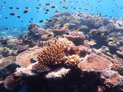
Australia Queensland and the Great Barrier Reef
Read More
Tioman Islands, Malaysia
Read More
The Riviera Maya
Read More
The Bay Islands, Roatan, Utila, Guanaja, and more.
Read More
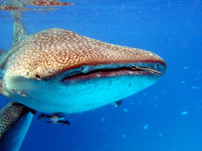
The Maldives: A Garland of Islands in the Indian Ocean
Read More
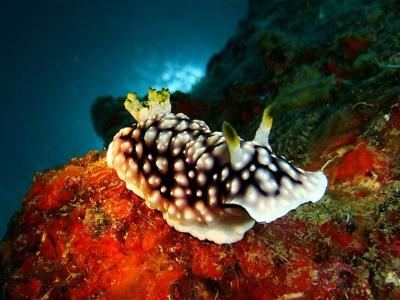
Cebu and the Visayas Islands
Read More
Tobago. The Less Known Dive Vacation Island
Read More
Thailand’s Amazing Andaman Sea
Read More
Cayman Brac – The Adventure and Tranquility Island
Read More
TRUK LAGOON
Read More
Connect With Us
Search for:
Recent Posts
Exploring Family-Friendly Dive Trips
Tips for Making the Most of Your Dive Trips
Challenging Dive Trips for the Experienced Diver
The Role of Dive Resorts in Marine Conservation
How to Choose the Right Liveaboard Dive Trips for Your Skill Level
Unique Dive Trips That Explore Historical Shipwrecks
Exploring Dive Trips You Never Knew Existed
The Most Luxurious Dive Resorts Around the World
Discovering Hidden Gems in Lesser-Known Locations for Your Next Dive Trip
Eco-Friendly Practices at Top Dive Resorts
Categories
Australia
Bahamas
Bay Islands
Belize
Blue Hole
Bonaire Diving
Borneo
Cayman Brac
Cayman Islands
Cozumel
Curacao
Cuttlefish
Dive Destinations
Dive Equipment
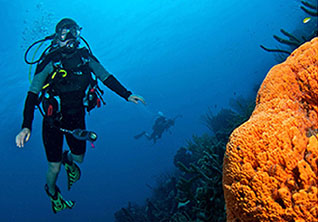
Dive Liveaboards
Dive Resorts / Properties
Dive Travel
Dive Travel Deals
Diver Wellness
Dolphins
Dominica
Eagle Rays
eagle rays
Family Travel
Fiji
Galapagos Islands
Great White Shark cage diving
Guanaja
Honduras
Indonesia
Infographics
Isla Mujeres
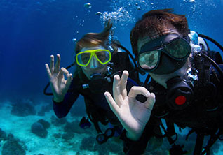
Learning to Dive
Little Cayman
Maduro Dive Newsletter
Malaysia
Maldives
Manta Rays
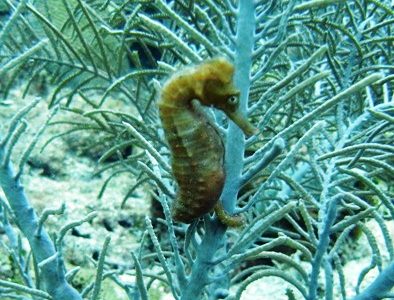
Marine Life
Mexico
Micronesia
Muck Diving
Myamar
Palau
Papua New Guinea
Pelagics
Philippines
Pinnacles
Polynesia
Reefs
Riviera Maya
Roatan
Saba
Sabah
Scuba Diving
Scuba Gear Reviews
Scuba News/Events
Scuba Training & Education
Sea Legends
sea lions
Sea of Cortez
Sharks
Single Travel
Sipadan
Socorro Islands
South Africa
Specialties
ST. Kitts
Stingrays
Tahiti
Thailand
The Bucket List
Tobago
Truk Lagoon (Chuuk)
Turks and Caicos Islands
Turtles
Uncategorized
Underwater Photography
Underwater Video
Utila
Walls
Whale Sharks
Whales
Wreck Diving
Wrecks
Yap
Archives
April 2026
March 2026
February 2026
January 2026
November 2025
October 2025
September 2025
August 2025
July 2025
June 2025
January 2024
April 2023
March 2020
March 2019
January 2019
November 2018
September 2018
July 2018
May 2018
March 2018
January 2018
October 2017
September 2017
June 2017
April 2017
February 2017
January 2017
October 2016
August 2016
July 2016
May 2016
March 2016
February 2016
January 2016
December 2015
August 2015
June 2015
April 2015
January 2015
November 2014
July 2014
April 2014
February 2014
December 2013
November 2013
October 2013
September 2013
August 2013
July 2013
June 2013
May 2013
April 2013
March 2013
February 2013
January 2013
December 2012
November 2012
October 2012
September 2012
August 2012
July 2012
June 2012
May 2012
April 2012
Sizzling Specials
All Inclusive | Condo | Family
Adventure Activities
Client Testimonials
Maduro Memberships and Accreditations
Receive Our E-newsletter for the best dive deals and news
Your email address is never shared